

Climate Chaos is here today. Dr Masters explains how the melting of the Arctic is linked to the historic Asian heatwave, causing hotter seas to breed typhoons that penetrate far north. Maysak became a terrific extra tropical storm with a chaotic 320 kph jet-stream, in turn causing record ridges, exploding the Californian fire infernos, a winter storm in September, etc .
Meanwhile the US oligarchy and all its vassal States promote a Covid-19 recovery based on the exact same debt, consumption and fossil fuels formula that is causing our spiraling climate and biosphere collapse.
Extreme tropical cyclones can breed extreme jet stream behavior
By Jeff Masters, Ph.D. | Monday, September 7, 2020 ( extract from his post Tropical Storm Paulette… shared with thanks)
As Typhoon Maysak plowed northwards towards Korea during the first two days of September, it was able to maintain its intensity unusually far to the north because of near record-warm ocean waters created by one of the greatest heat waves in east Asian history.

Ocean temperatures in late August south of Korea were 30 degrees Celsius (86°F) – more than two degrees Celsius (3.6°F) above average. The intense heat wave that helped create these unusually warm ocean waters also brought Japan its hottest day in recorded history – Hamamatsu, Japan, on August 17 tied the record set in 2018 for hottest temperature ever measured in Japan, with 41.1 degrees Celsius (106°F). The extreme heat has carried over into the first week of September, with Sanjo, Japan, setting the nation’s all-time September heat record on September 3, with 40.4 degrees Celsius (105°F).
Supercharged by this remarkable ocean heat, Maysak was able to make landfall in South Korea on September 2 as one of only five category 2 or stronger typhoons on record since 1945 to hit the nation.

Infrared image of Typhoon Haishen from the VIIRS instrument at 16:39 UTC September 3, 2020. At the time, Haishen was a rapidly intensifying category 4 storm with 145 mph winds. (Image credit: University of Wisconsin CIMSS)
When Maysak merged with the jet stream as a powerful extratropical storm on September 2nd and 3rd, the supercharged storm injected a tremendous amount of energy into the jet stream, helping accelerate the winds of that mighty river of air to nearly 200 mph – a wind speed nearly five standard deviations above average.
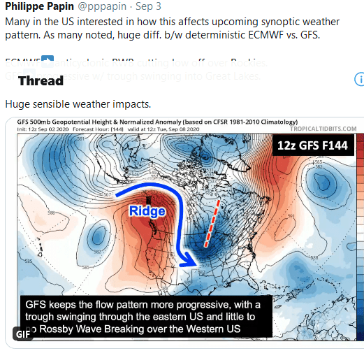
As shown in the tweet (click this link to animate and see the full explanation), the jet stream responded to Typhoon Maysak’s energy by contorting into a series of amplified ridges and troughs downstream from east Asia during Labor Day weekend.
That in turn led to formation of an unusually strong trough of low pressure over Alaska, development of a record-intensity ridge of high pressure over the western U.S., and an unusually strong trough of low pressure now taking shape over the Rocky Mountain states.
How climate change is making hurricanes more dangerous
The ridge over the western U.S. brought all-time record heat and intense wildfire activity to many locations in California September 5 – 6. The intense trough of low pressure developing over the Rocky Mountain states is predicted to bring a startling case of weather whiplash to Colorado: places where it was 100 degrees Fahrenheit on Sunday will get snows of 3 – 7 inches on Tuesday. In some locations, these may be the earliest snows on record for the season.

Figure 5. This personal weather station in Denver marked a rare feat on Sunday, September 6: a temperature of 100 degrees Fahrenheit with a concurrent Winter Storm Watch. The official high at the Denver International Airport on Sunday was 97 degrees. (Image credit: Weather Underground, an IBM company)
The unusual jet stream behavior behind the current extreme U.S. weather was made more likely by global warming, as part of the ocean warmth that enabled Typhoon Maysak to penetrate so far to the north at high intensity occurred because the planet as a whole is on pace for its warmest or second-warmest year on record – behind only 2016.
As explained in a 2014 paper by Kossin et al., “The poleward migration of the location of tropical cyclone maximum intensity,” typhoons and hurricanes have been growing more intense farther to the north in recent decades, and this effect can be plausibly linked to the changes in global circulation that are causing an expansion of the tropics, which is thought to have a significant link to human-caused global warming.

Winter Storm Watch in effect, record lows forecast sept 6th 2020
The unusual jet stream behavior may also be linked to the near-record decline in Arctic sea ice currently underway. As of September 7, coverage of sea ice in the Arctic was the second-lowest on record, behind only 2012, according to the National Snow and Ice Data Center. This is an area of active research, but numerous studies in recent years have linked Arctic sea ice loss to unusual jet stream behavior of the type now occurring (see the excellent June 2020 summary at Carbon Brief).
Website visitors can comment on “Eye on the Storm” posts (see below). Please read our Comments Policy prior to posting. (See all EOTS posts here. Sign up for notice of new postings here.)
Posted on September 7, 2020 (3:41pm EDT)
( extract from Dr Master’s post Tropical Storm Paulette… shared with thanks)

One thought on “California Inferno and Winter Storm linked to Typhoons and Climate Chaos”